There are tribes there who seem unaffected by western influence and change and keep to their tradition after all this time.
I also spent time with a special family and also managed to enjoy the local food.
All the eastern parts of Laos was heavily bombed during the Vietnam War. More bombs were dropped in this area than the number of bombs dropped during the entire Second World War (approximately 10,000 bombs for every citizen of Laos). Laos has the sad reputation of being the most heavily bombed country in the world ...
The Ho Chi Min trail went through Laos, and the Americans tried to destroy it with every means. They tried everything from carpet bombing, dropping cases of Budweiser Beer (hoping that the Vietnamese soldiers would get drunk) to dropping washing detergent during the wet season (hoping the trail would get slippery). It is estimated that the Americans only succeeded in stopping 10 percent of the traffic on the trail.
In Vietnam, the Americans were not allowed to bomb within 500 meters from temples and hospitals. Their rules of engagement furthermore said that they were not allowed to return to their home base with a bomb load. The result was that they flew across the border to Laos and dropped all their bombs there. In Laos, there were no rules of engagement. They could bomb whereever they wanted to bomb.
This also means that there is quite a large amount of UXO (Unexploded ordnance) in the country. Land mines and unexploded cluster bombs (shown on left) are some of the biggest problems.
Sad as this may seem, people have been pretty creative about using some of the leftover bombs. In this case they have used a couple of 2000-pound bombs as decoration outside the house.
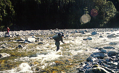
In all the local villages there are unexploded bombs and shells from the cluster bombs.
A lot of the remains from the war are sold as scrap metal. In this pile there are shells from cluster bombs, wheels from tanks etc. >>>
Here as fence posts outside a house. >>>
Outside a school, the schoolyard was surrounded by the shells from the American cluster bombs.
There are still areas where there are lots of problems with guerilla warfare. This is especially the case on Route 7, along the eastern border towards Vietnam and in the western part of Laos west of Vientiane, in the area between the Mekong River and Thailand.
The government is trying to control these problems, but it is difficult with such wast areas of jungle.
Unfortunately such incidents have affected a lot of people. This girl is not the only person in Laos who has lost her family.
Remember that the area has virtually been a permanent warzone since the Vietnam war, until the mid 90’s.
You couldn't really tell that things are pretty bad in some parts of the country.
The northern part of Laos is especially poor. The mountainous terrain limits what can be grown. Outdated farming methods using “slash-and-burn” of whole mountainsides are not very appropriate for feeding a growing population.
A lot of the western countries are represented in Laos with health care workers. What Laos really needs at the moment is help using more environmentally-friendly farming methods, which at the same time improve the growing of crops. The slash-and-burn method basically means they burn a whole mountainside to grow rice. There is nothing left to hold back the nutrients in the soil, and fertiliser is not added. After a few years there are no more nutrients on this mountainside and they move on to the next mountainside. They need to learn how to grow crops in terraces and add fertiliser from their animals to the soil.
One of the problems with growing rice is that the men are unempleyed most of the year while they are waiting for the rice to grow.
Vinchu is working for the Swiss Red Cross. She intends to buy a piece of land in the 32-kilometre village of Muang Xai, and convert it into a fish farm. This would keep some of the men occupied for most of the year. The profit from the fish farm could be used to take careIsland-1998" class="taggedlink">New Zealand South Island 1998
 New Zealand ( June 1998 ) . . .
My first trip to New Zealand took place in June 1998. I travelled with the Lenehans - friends I have known since my arrival in Australia. This was one of many trips I took with Lance and Anne. We rented a campervan and decided to explore the south island of NZ.
I have since been to New Zealand again - NZ has some of the most beautiful mountains and I had the chance to go there again in January 2001 to do a technical ice-climbing course.
I took so many photos and would have loved to place all of them on this webpage.
Instead, I have selected a few to show some of the places I managed to go to, such as Milford Sound, Nelson, Arthurs Pass and Mt Cook.
There were many glaciers in NZ and lots of seals to go with them!
NZ is a beautiful country with many unusual natural formations. It is a photographer's haven. We ended our trip with a farewell dinner in Christchurch.
 Seals . . .
The Lenehans and I decided to spend 2 weeks in New Zealand in the winter of 1998. We flew to Christchurch from Sydney, and drove north to Nelson.
On the way to Nelson, on the east coast of the southern island, there are hundreds of seals. It was a spectacular sight and I managed to get quite close to them to take photos.

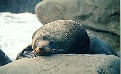

They did not seem to mind me taking a few photos. Some of the seals look tired - I guess even seals, like humans become tired. Who wouldn't like to pet a seal? They look different when they are wet though.

This was taken near where the seals were. I like the blend of colours and the harmony of the picture.
A lot of friends have commented on this photo! Most of them really like the photo, and feel there is something calm about it.
 Nelson . . .
Nelson is located at the northern most part of the southern island.
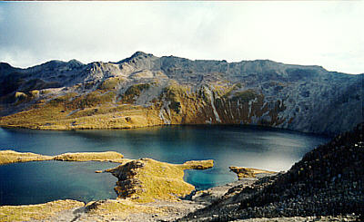
We explored the area around Lake Rotoiti.

These were taken from the ridge itself.
There is a lake at the end of the mountain ridge. From here, it is all downhill. We camped just below the lake at 1,500 metres altitude.
It was snowing the next morning and all water was frozen. We estimated the temperature to be around -7 degrees celcius.
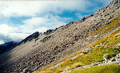
The side of the ridge was one big stonefall.
It was very cold and the wind was strong that day so it was necessary to wear gloves hat.
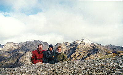
We managed to get a group shot from the top of the ridge. The mountains in the background are knows as the McAngus ridge at Lake Rotoiti.

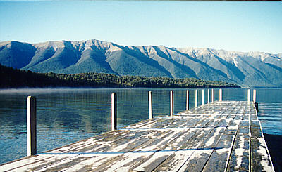
Here are the mountains at Lake Rotoiti.
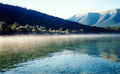
The mornings are incredibly beautiful at Lake Rotoiti. Here you can see the morning mist floating gently on the water.
It is also very cold here - that is why there is ice on the bridge in the foreground.

The photo on the right shows the Lenehans crossing one of the suspension bridges at Lake Rotoiti.
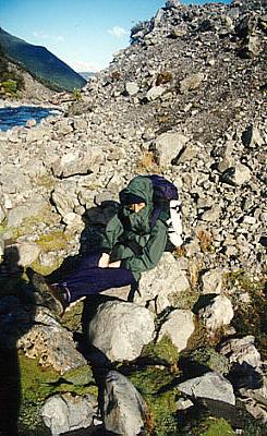
At this point we had walked 15 kilometres, with a 1,000 metre descent. We had yet another 7 to 8 kilometres to go that day!

This is what happens when you do not use a tripod. The effect is quiet interesting and makes the photo look like a painting by Monet.
This photo has has been dubbed "The Renet" among my friends.
 Arthurs Pass . . .
We drove to Arthurs Pass, on the way from Nelson to Queenstown further south.
There is a place called Goat Pass, and there is only one way in - on foot.
Here, you can see Anne climbing up ladders on the Goat Pass track.
It was raining so much that we were not able to get down through the canyon on the other side of the Pass. We therefore decided to go back the way we came.
Further down the track, we had passed a bivouak and decided to stay ther during the night. It was very dirty and Anne would rather sleep outside in the rain.
Everything was wet so she changed her mind and came back in. *laugh*
She wore plastic bags on her feet,
in her boots are so that she could wear her boots without getting cold feet! Aussies will never get used to the cold.
Here is Anne crossing one of the rivers.
Every time she crossed a river, she would sit and massage her feet for 10 minutes until they warm again.
I guess Aussies will never get used to the cold. Neither will Danes for that matter! An Australian winter is like a Danish summer - so you can imagine how cold Denmark is! Still, Danes cannot get used to it - just ask Kenneth or Soeren!
Sleeping ???
Aussies will never learn to live with the cold!
I must admit I hate the cold. I loved it when I lived in Kenya - so hot and humid!
Even living in Denmark for all those year did not make me like cold weather any more than I used to. That is why I love Australia - warm summers and mild winters. Sometimes winter in Australia is a bit too cold for me! But I do not usually wear more than a T-shirt or a thin jumper in winter. My girlfriend was complaining about me having the heater on full-blast in the car during spring!
Okay, so I love the heat!
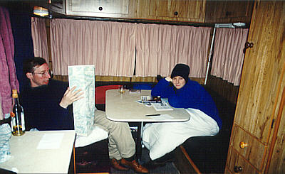
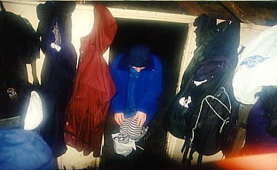
Inside the campervan.
Temperature was down to -10 degrees Celcius during the night and there was no heating in the van.
This explains why Anne was wearing a thick blanket. There was only enough water for a two minute shower. That is why Anne is wearing a hat indoors.
See the expression on her face? She knows I will write a stupid description for this photo.
In the campervan I had the top bunk.
This is one of my girlfriend's favourite photos!
On the way to Milford Sound, we saw some unusual formations - The Pancake Rocks. The Pancake Rocks are located near Hokitika, between Kumara and Ross.
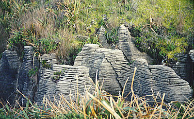

They do not taste as good as real pancakes - you get sand in your teeth...
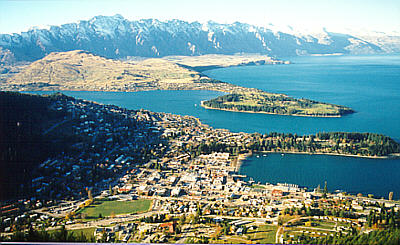
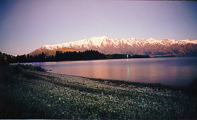
At Queenstown, we had the most glorious view of "The Remarkables". The Remarkables are the mountains in the background - don't ask me why they call The Remarkables, I don't know. But the photo on the left shows Queenstown with these mountains in the background.
The photo on the right shows the a sunset at The Remarkables (with snow on top!) Pretty 'remarkable', huh?
 Milford Sound . . .
Milford Sound is located near the southern-most tip of the south island of NZ. It is the series of 'islands' that you can see on the western tip of NZ on the map.
To get to Milford Sound, we had to take a huge detour from Queenstown. To come back from Milford Sound, we had to take the same detour before heading east from Queenstown.
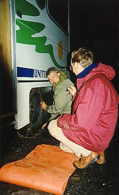
Driving down to Milford Sound, we had to put chains on the tyres of the campervan.
In the pass, there was at least 10 centimetres of snow on the road, and it was illegal to continue on without chains. Chains help create friction on the roads and makes it easier for the vehicle to drive on in icy conditions.
We managed to rent a set of chains in Te Anau because we had heard rumours about chains being mandatory.
If you go to New Zealand during the winter, then make sure you have a set of chains for the car.
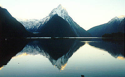
How many postcards have you seen from Milford Sound, where there was snow on top of the mountains?
It is beautiful, but nothing compared to the Mount Cook area.
The sun rising in the Milford Sound area.
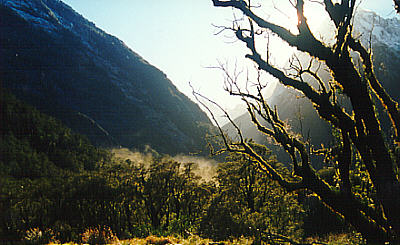
Glaciers . . .
Most of the glaciers we went to were located on the main range.
We had to drive inland when we were heading south on the west coast because the Westland was too rough and wild to drive through.
Here on the right is the Tasman glacier near Mt Cook village. It is 35 km long - a hundred years ago it was 85km long. The ice is 600m thick and used to be 1,300m thick.
Where the glacier ends at the water on the photo, the ice is more than 200m thick.

Both the Fox and Franz Josef glaciers are located on the west coast.
On the left is The Fox Glacier.
It is so huge that if you built a house at the end where the ice begins (or ends since it is a glacier), you would not be able to see it on this picture.
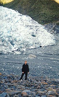
The pile of ice behind me are 3 to 4 times bigger than the size of a house.
I am standing about half a kilometre from the glacier.


At the Franz Josef glacier, people have been feeding the keas. The kea is the only alpine parrot in the world.
This means the keas associate every man-made thing with something edible.
They are therefore making the attempt to eat the cars. You can see the keas on the roof of our campervan.
It is a very weird bird. They can survive in extreme conditions with freezing temperatures and snow.
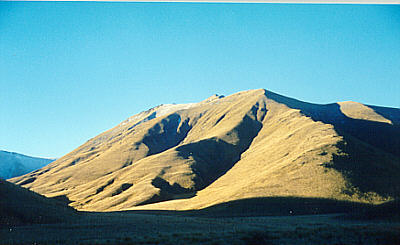
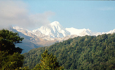 Mount Cook . . .
On the way back to Christchurch, we went to Mt Cook.
Here is Mt Cook as seen from the west coast.
I achieved my goal to climb it in January 2001! You can see the photos from this trip.
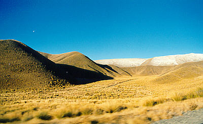
Take a look at the colours. The photos were taken at Lindes Pass, just north of Mount Cook.
There was no sound up there. You could not hear the wind or any birds. The only sound you could hear was yourself breathing.
Lance praying towards Mecca???
No just Lance in a weird posture taking a video of Mt Cook.
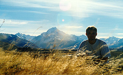
One of my favorite photos.
"The man and his mountain". Kerenyaga.
Here is Mt Cook in the background (almost 4,000 meters). I am so glad that I had the opportunity to go back to NZ and actually climb on Mt Cook!
 Farewell Dinner . . .
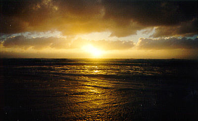
From Milford Sound, back to Queenstown, we then drove back to Christchurch via the east coast. We saw some pretty spectacular sunrises along the way.
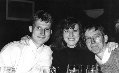
During our last night in New Zealand, we went to a restaurant called "The Sign of the Takahe". We had our farewell dinner at Christchurch before returning to Sydney.
It is an old castle/house built in the same style as the old English castles. The atmosphere and food is excellent.
This is the place to bring a date.
Someone was playing quiet piano music in the hall.
The photo is taken with a long exposure because I wanted to capture the atmosphere with the woman playing the piano in these old surroundings.

Created: Jan 2000 Last Updated: 19 Sept 2001