28. July 2001 10:46
by Rene Pallesen
0 Comments

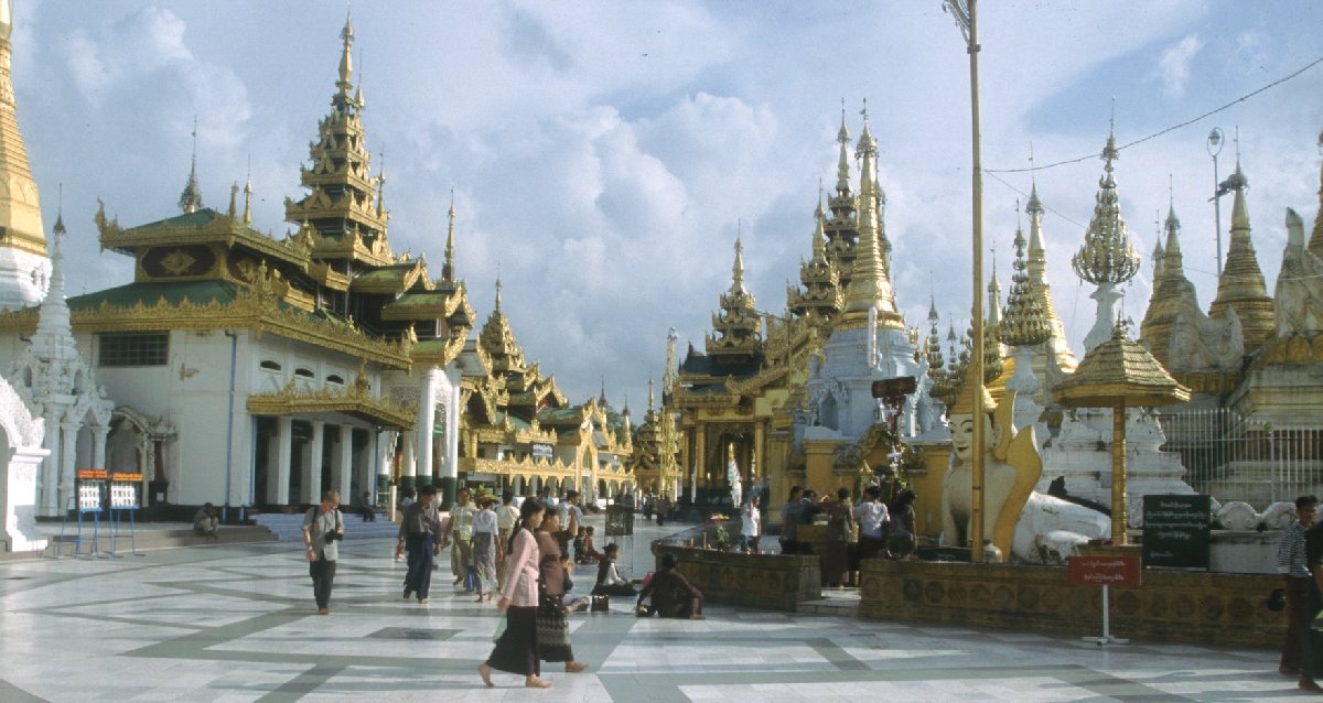
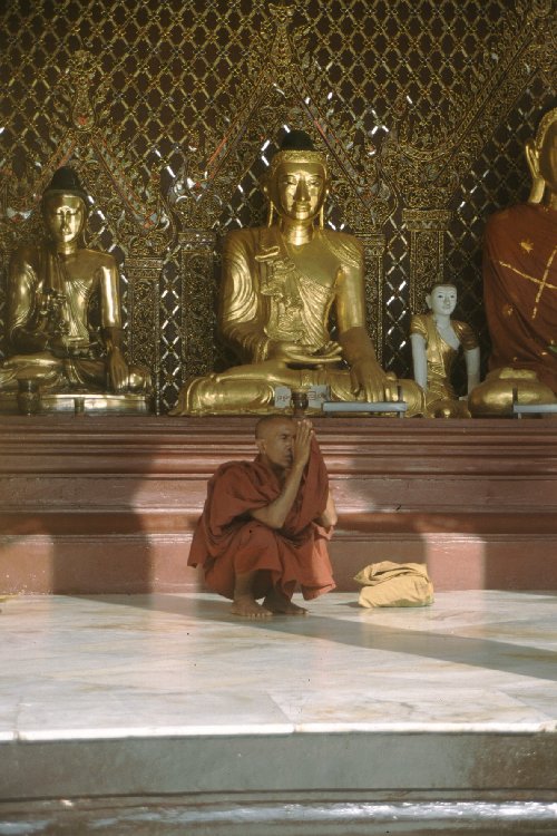
Schwedagon was a holy place with extremely large and beautiful temples.
To get to Schwedagon, you had to travel up very long escalators. I took this photo because these escalators were the only escalators I had seen during my whole trip in Burma. As Schwedagon is a very religious place for the locals, I guess to travel up these escalators give the sense of travelling to a higher and holier place.
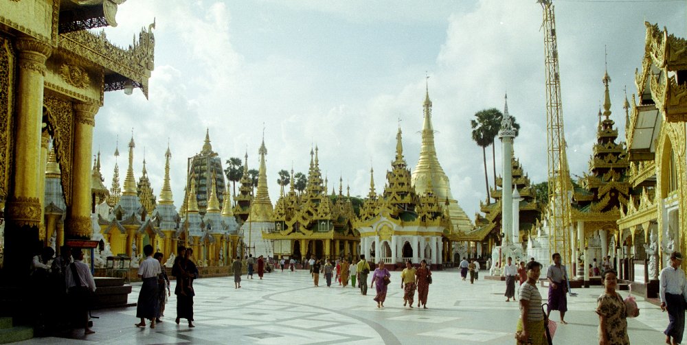
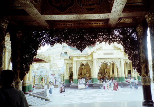
The temples at Schwedagon were really impressive.
 I was told that collectively, these temples were built with 39 tonnes of pure gold.
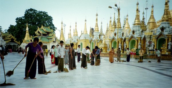
At the end of the day, the locals all contributed in cleaning the place. They clean all the tiles and are very organised.
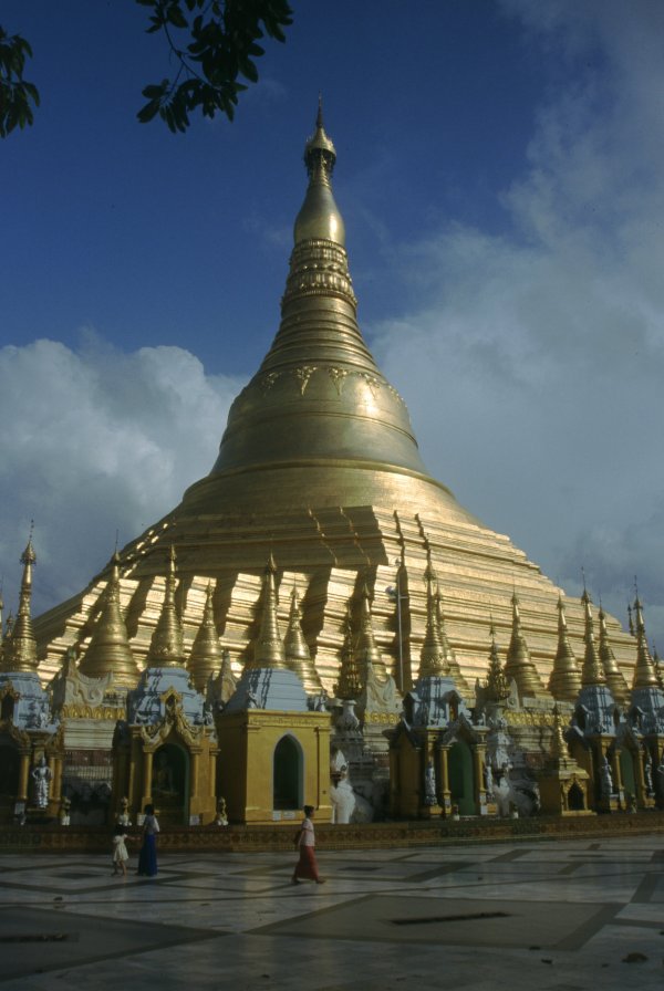
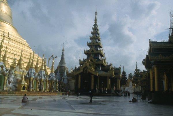
Here is the 'Big Stuba'. All that gold...
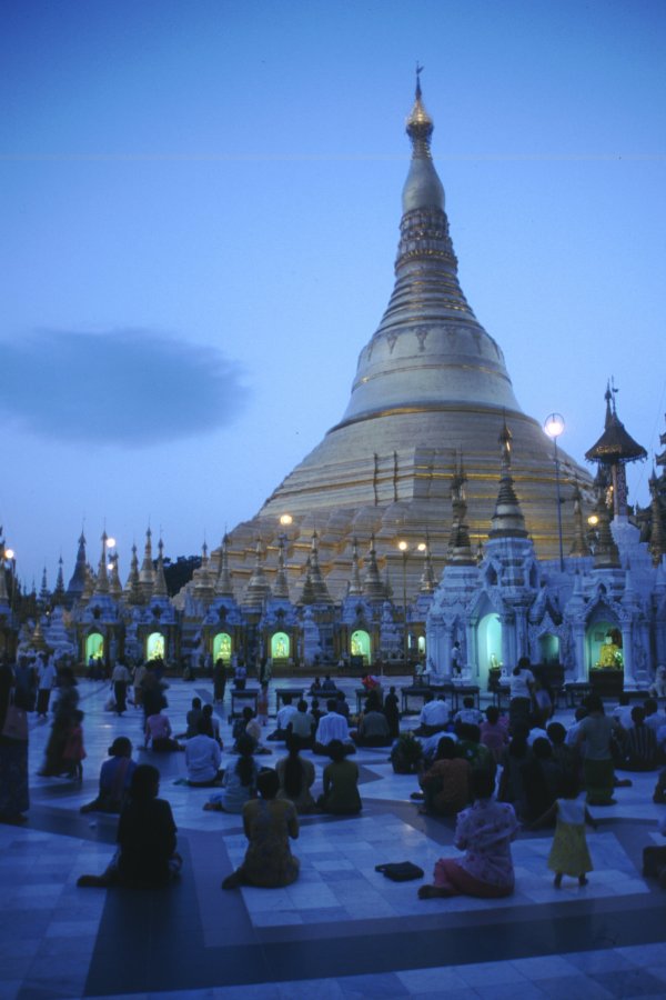
Up close, the temples are a glorious sight. Especially at night!
Can you see those lights at the base of the Big Stuba? Each is a 'mini temple', illuminating a Buddha.
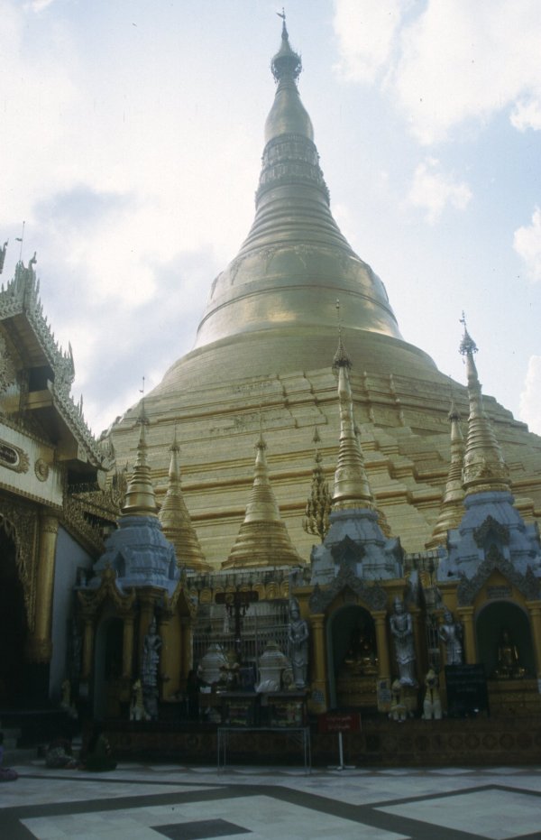
You can really see the magnificence of these temples!
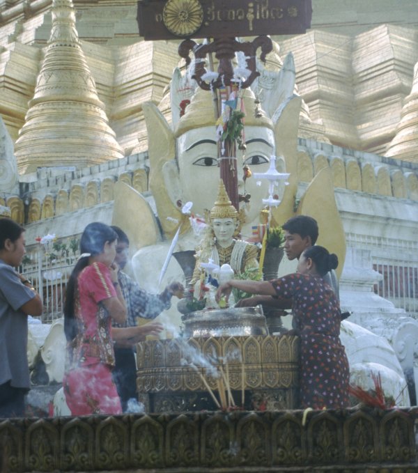
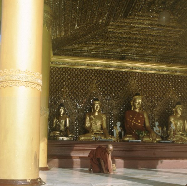
 There are lots of rules or procedures about the way one prays to the Buddhas - very complicated to an outsider!
I saw a couple of the buddhists pour water onto the statue of the Buddha. Depending on the day of the week a buddhist is born, the individual would pour the respective number of bowls for the day of the week. A buddhist believes that by doing this, it would bring them luck.
At Schwedagon, I noticed there were hardly any tourists, mostly locals paying homage.
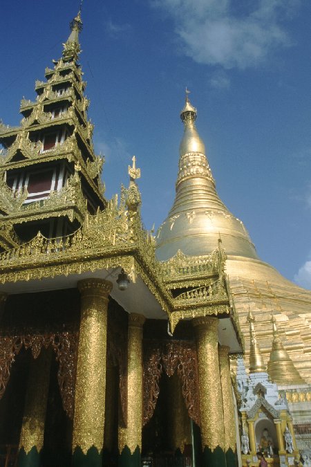
Can you see how intricate the carvings are in the foreground?
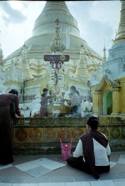
There are lots of rules or procedures about the way one prays to the Buddhas - very complicated to an outsider!
I saw a couple of the buddhists pour water onto the statue of the Buddha. Depending on the day of the week a buddhist is born, the individual would pour the respective number of bowls for the day of the week. A buddhist believes that by doing this, it would bring them luck.
At Schwedagon, I noticed there were hardly any tourists, mostly locals paying homage.
Can you see how intricate the carvings are in the foreground?
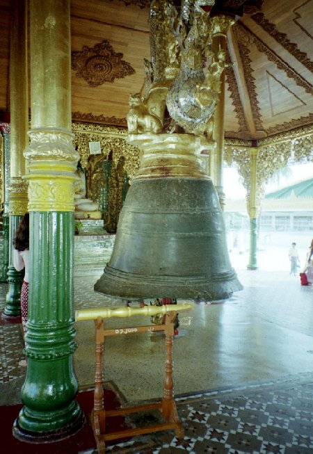
The monks rung this bell to announce prayer times.
It brought luck to ring the bell.
For example, if you were born on the 1st day of the week, you rung it once to bring good luck. If you were born on the 6th day of the week, you rung it 6 times etc.
28. July 2001 10:45
by Rene Pallesen
0 Comments
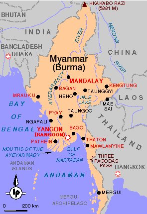
Burma/Myanmar surprised me in many ways. I would have liked to see more of Burma than I did, but due to military restrictions, I only had access to certain parts of Burma and was not able to see any of the indigenous people along the border as I had initially planned.Burma is a very poor country. It was difficult to travel... travelling 100 kilometres could sometimes take up to 6 hours.
One of the most beautiful places in Burma, I thought, was Bagan.
I took many photos in Burma, and tried to order them in the following pages:
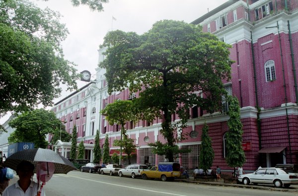
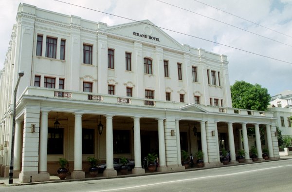
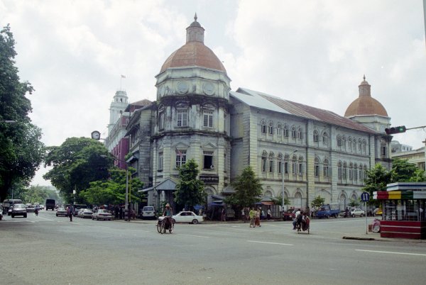
- I spent some days in Yangon, which had a heavy colonial influence.
- Schwedagon was another place full of temples, a place laden with pure gold.
- Whilst travelling, I could not help notice how influenced the people were by religion, and Burma's politics is one thing an outsider should not get involved in.
- I was fascinated by what the Burmese used for medicine. They also had some rather interesting local fruit.
- Mandalay also had an interesting colonial battle history. Whilst there, I watched the “Mandalay Marionettes”.
- With the restrictions up north, I did not get to see much. But you would not believe how the Burmese play volleyball!
- Finally, at Mt Popa, I went there to see a local monastry, and saw a lot of wild monkeys there.
 Yangon ( Rangoon ) . . .
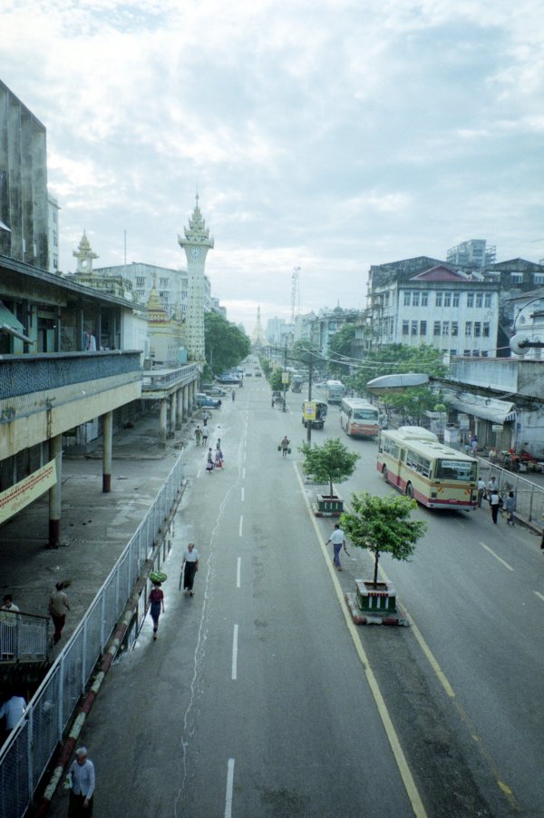
This is the city-centre of Rangoon. Rangoon is the capital city of Burma.
It is actually a pretty big city if you compare it with other parts of Burma on a map.
Most of the buildings are from the old colonial period when the British occupied Burma. Unfortunately they have not been very well-maintained.
Can you see the green bits on the clocktower?
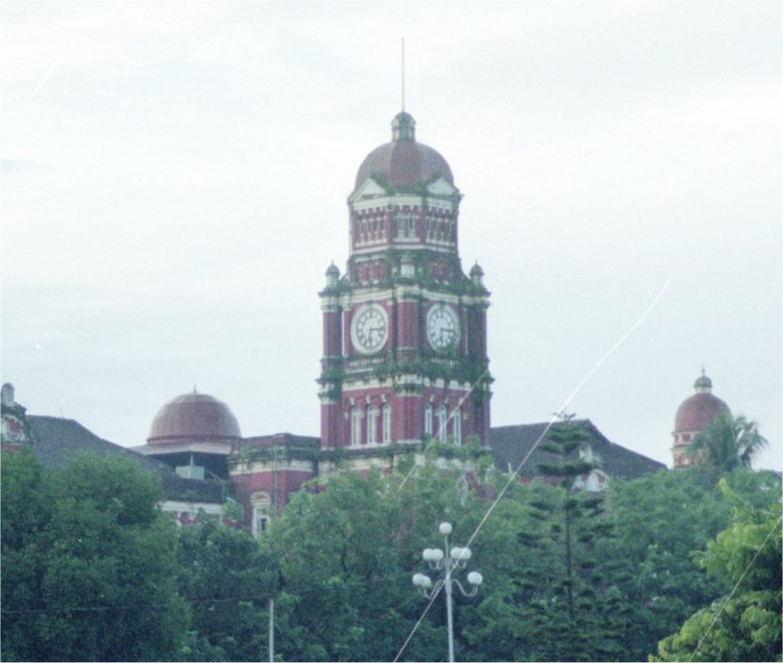
If you are thinking it is vegetation growing on it, you are right! There is quite a bit growing on most of the buildings in the city.
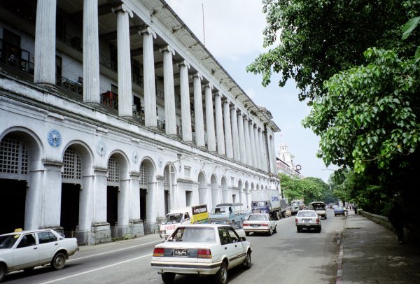
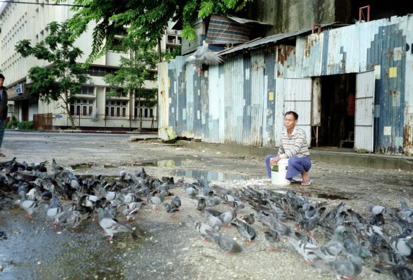
There were so many pigeons!
I managed to catch a pictures of a pigeon flying mid-air - can you see the blurred grey thing near the tree in the middle of the photo?
Next Return to SE Asia menuReturn to Top
Created: 22 Sept 2001
28. July 2001 01:56
by Rene Pallesen
0 Comments
15. June 2001 10:27
by Rene Pallesen
0 Comments
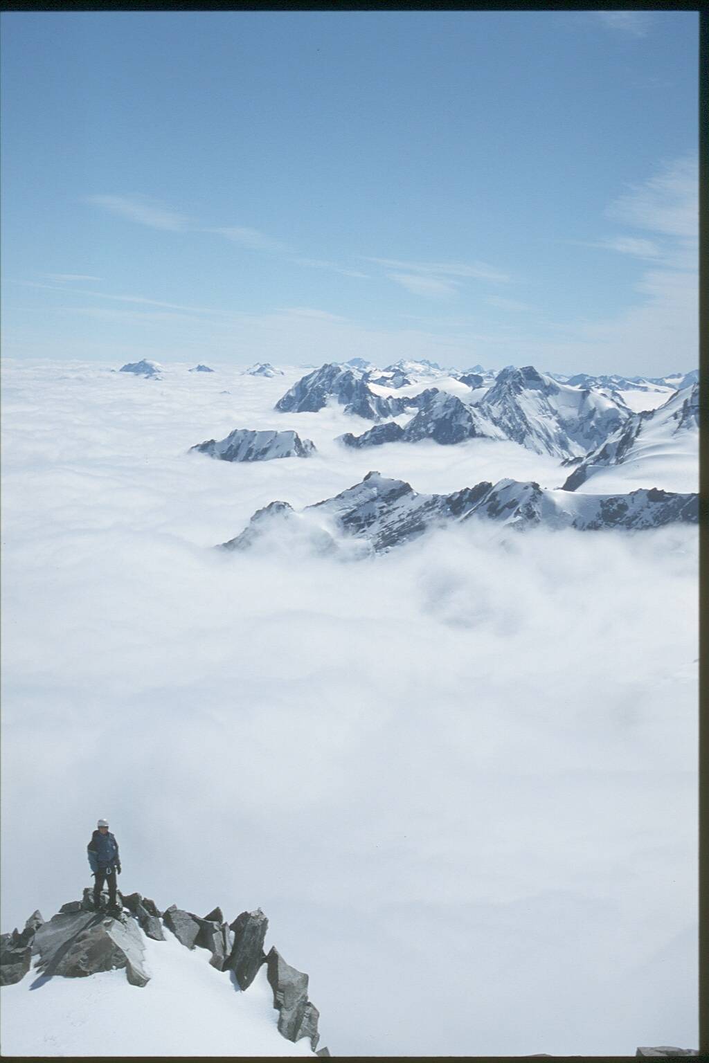
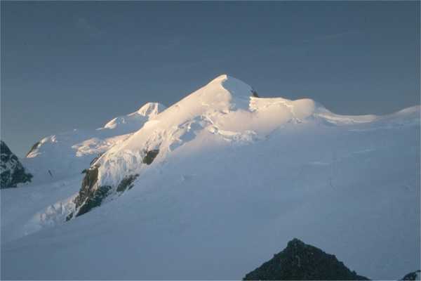
I took part in a photo competition in November 2001, using one of the photos I had taken during my trip to Mt Cook in January 2001. This photo was of Kevin, the alpine guide from my group in the technical climbing course.
The following photo and comments appeared on the Planet Fear website, in the Front Line Photography Competition - not long after I was notified that I was one of 20 winners, and I was even more surprised to find out that I had come third!
The comments above the photo were my comments that I had emailed to them when I sent the photo. The comments below the photo were (one of the judges) comments about my photo.
3. Rene Pallesen
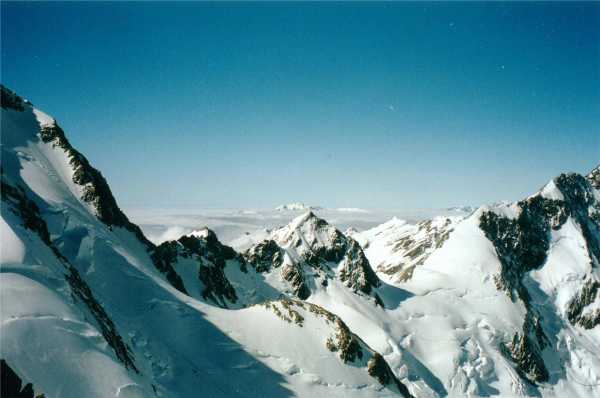
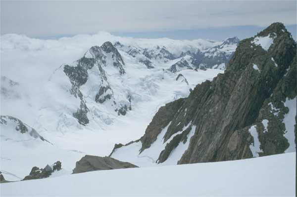
The attached photo was taken in New Zealand on the main range near Mount Cook. The valleys to the west are filled with clouds formed by the moisture from the forests underneath. The snowcovered mountains in the north are visible through the clouds. The photo was taking using a Nikon FM10 using a Fuji Sensia 100 film.
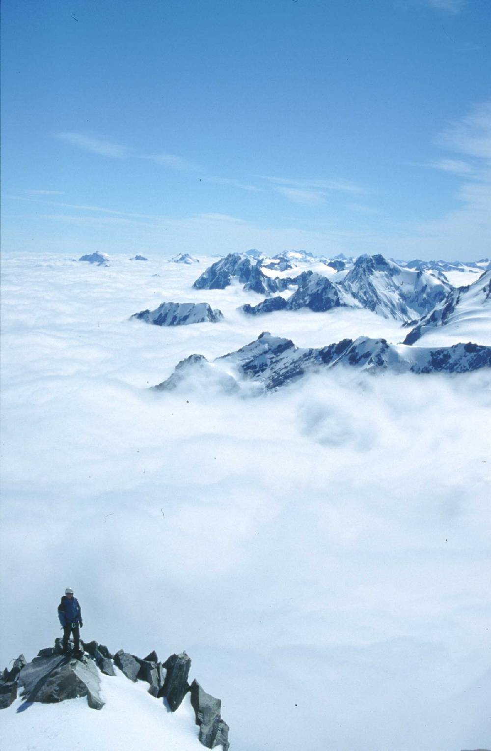
Literally bathed in atmosphere. It would be easy to muff this high key exposure but Rene is spot on. The vertical format adds to a shot capturing all the euphoria of life on the tops. Reminds me of the legendary Mountain mag front covers.
~ Comment by Ian Parnell, Planet Fear
|
Feel free to see
my photo on their website.
Also, you could go to the Planet Fear website to view the other winning photos.
15. January 2001 11:14
by Rene Pallesen
0 Comments
Created: 18 Aug 2001 Last Updated: 16 Sept 2001
15. January 2001 10:59
by Rene Pallesen
0 Comments
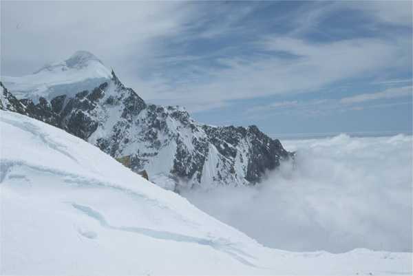
 Mt Cook ( 15 ~ 28 January 2001 )I decided to do a Technical Ice-Climbing course with Alpine Guides in New Zealand.
I spent 10 days at Mt Cook doing a very challenging course, but I learnt a lot. I learnt all the techniques required to do ice-climbing safely. I also learnt the necessities of surviving in the icy mountains.
Prior to the trip, a lot of preparation was required. Everyday, I went jogging to build up my fitness, so by the time I left for New Zealand, I could run 3km on the sand without getting puffed. I also had to buy some of the equipment. I had to buy cramp-ons (looks like spiked metal soles) to attach to my boots; ice-axe and ice-hammer; a new Gore-tex jacket (I needed a new one anyway) and some other clothing and equipment.
The photo on the right became a 3rd-place winner in a photo competition.
Mt Cook ( 15 ~ 28 January 2001 )I decided to do a Technical Ice-Climbing course with Alpine Guides in New Zealand.
I spent 10 days at Mt Cook doing a very challenging course, but I learnt a lot. I learnt all the techniques required to do ice-climbing safely. I also learnt the necessities of surviving in the icy mountains.
Prior to the trip, a lot of preparation was required. Everyday, I went jogging to build up my fitness, so by the time I left for New Zealand, I could run 3km on the sand without getting puffed. I also had to buy some of the equipment. I had to buy cramp-ons (looks like spiked metal soles) to attach to my boots; ice-axe and ice-hammer; a new Gore-tex jacket (I needed a new one anyway) and some other clothing and equipment.
The photo on the right became a 3rd-place winner in a photo competition.
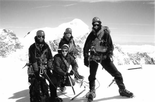
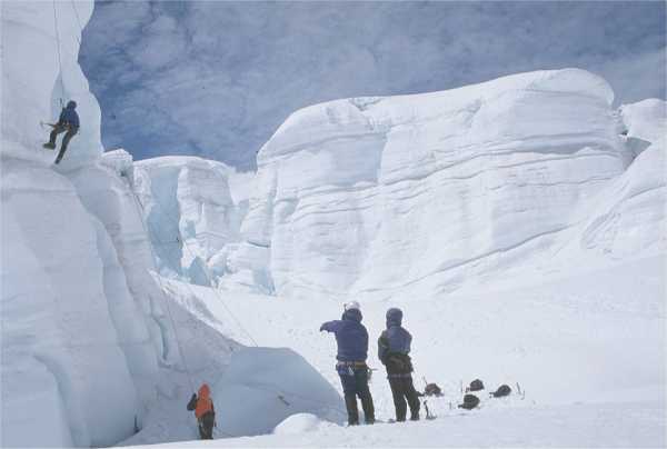
Our group consisted of 4 other doing the course. There were no prerequisites, other than a love for the mountains and a very high fitness level. Not all of us who do this course go on to climb the great mountains. We also discovered it takes guts and courage to stand on top of the world and feel confident. One cannot be an ice-climber if there is a fear of heights or if unsteady on the feet.
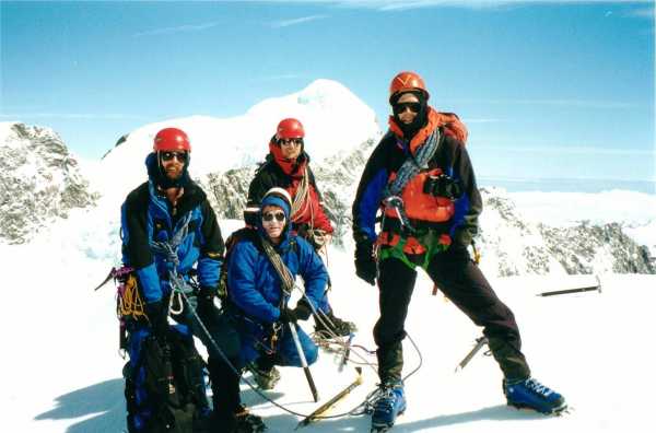
All of us in the group had come from different backgrounds. Søren was an experienced climber, who had aspirations of going to the Himalayas. Alan was a rock-climber who wanted to try the challenge of ice-climbing. Rob too loved the mountains and wanted the experience and challenge of being on the icey slopes of New Zealand. I had had quite a lot of climbing and mountaineering experience, but this was my first time ice-climbing.
The person holding the camera is Søren. I met him in NZ, whilst waiting for the bus for Mt Cook. To my surprise, he was a Dane living here in Sydney. He was a professional photographer (hence you see him holding the Nikon). He and I had similiar experience so our speed through the course was pretty much the same.
 I actually ended up cracking a rib whilst on the course. I did this during a 'self-arrest' technique, where we actually throw ourselves down a steep slope and try to use our ice-axe to stop ourselves from falling any further. This technique is used in case you fall down a crevass and have nothing to hold onto.
Rob was the other person doing the course. He once dropped his ice-axe and one of us had to abseil down to collect it, as an ice-axe is a piece of equipment that is vital and you only carry one of these each.
We worked in pairs, but had to swap partners as our guide took turns working with each of us.
I actually ended up cracking a rib whilst on the course. I did this during a 'self-arrest' technique, where we actually throw ourselves down a steep slope and try to use our ice-axe to stop ourselves from falling any further. This technique is used in case you fall down a crevass and have nothing to hold onto.
Rob was the other person doing the course. He once dropped his ice-axe and one of us had to abseil down to collect it, as an ice-axe is a piece of equipment that is vital and you only carry one of these each.
We worked in pairs, but had to swap partners as our guide took turns working with each of us.
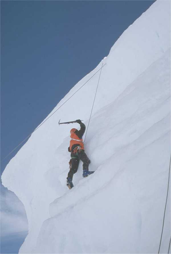
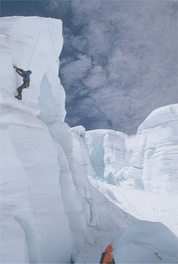
 Ice-climbing is nothing like rock-climbing. You cannot use your fingers (well, they will freeze if you take your gloves off), so you really on equipment like ice-axe and ice-picks to anchor yourself into the ice. These pieces of equipment are really important, especially if you are sleeping on a ledge or stopping for a rest. Other than someone belaying you, using ice-picks to secure yourself into the ice is the backup should your belay fail.
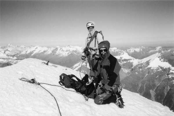
We each took turns at ice-climbing! Alan is the one in the blue jacket, Søren is the one in the red.
I guess Søren has more photos of me climbing, whereas I can't take photos of myself!
Ice-climbing is nothing like rock-climbing. You cannot use your fingers (well, they will freeze if you take your gloves off), so you really on equipment like ice-axe and ice-picks to anchor yourself into the ice. These pieces of equipment are really important, especially if you are sleeping on a ledge or stopping for a rest. Other than someone belaying you, using ice-picks to secure yourself into the ice is the backup should your belay fail.
We each took turns at ice-climbing! Alan is the one in the blue jacket, Søren is the one in the red.
I guess Søren has more photos of me climbing, whereas I can't take photos of myself!
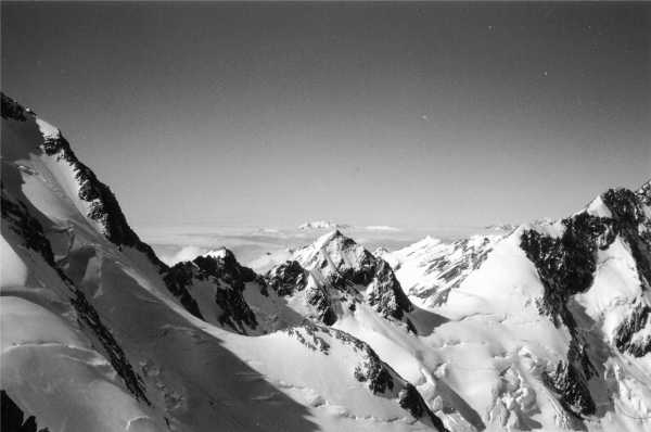
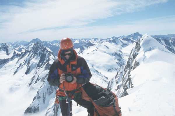
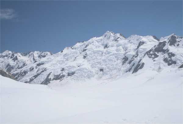
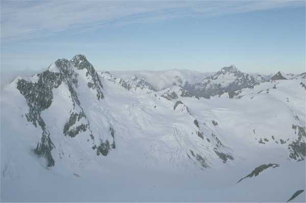
In the following section, you will see a series of photos of Mt Cook.
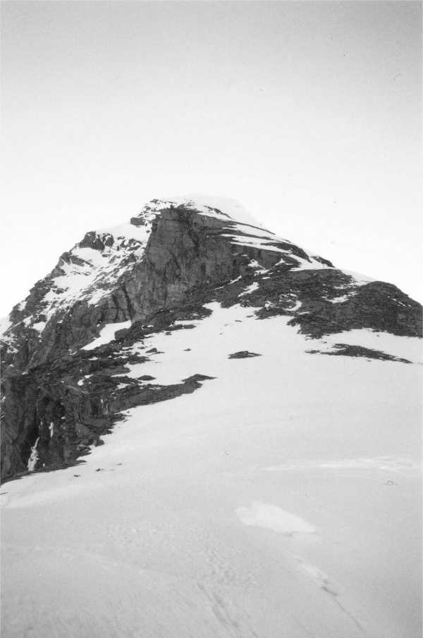
If you want to have a look at the black & white version of this (quite artistic), click here.
17. September 2000 10:58
by Rene Pallesen
0 Comments
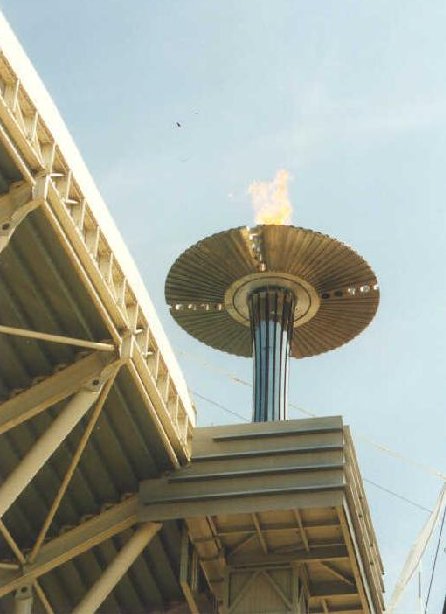 Last September, Sydney held the Olympic Games. I saw a lot of the events on TV but was disappointed with the coverage of other countries' involvement.
However, I did manage to be at Olympic Park during the Games and also see the first handball match - Denmark vs Norway.
I managed to get tickets for the game and had a very nice day with my girlfriend and the Lenehans. I also managed to get some pretty spectacular photos of the Olympic torch.
Last September, Sydney held the Olympic Games. I saw a lot of the events on TV but was disappointed with the coverage of other countries' involvement.
However, I did manage to be at Olympic Park during the Games and also see the first handball match - Denmark vs Norway.
I managed to get tickets for the game and had a very nice day with my girlfriend and the Lenehans. I also managed to get some pretty spectacular photos of the Olympic torch.
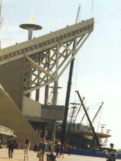
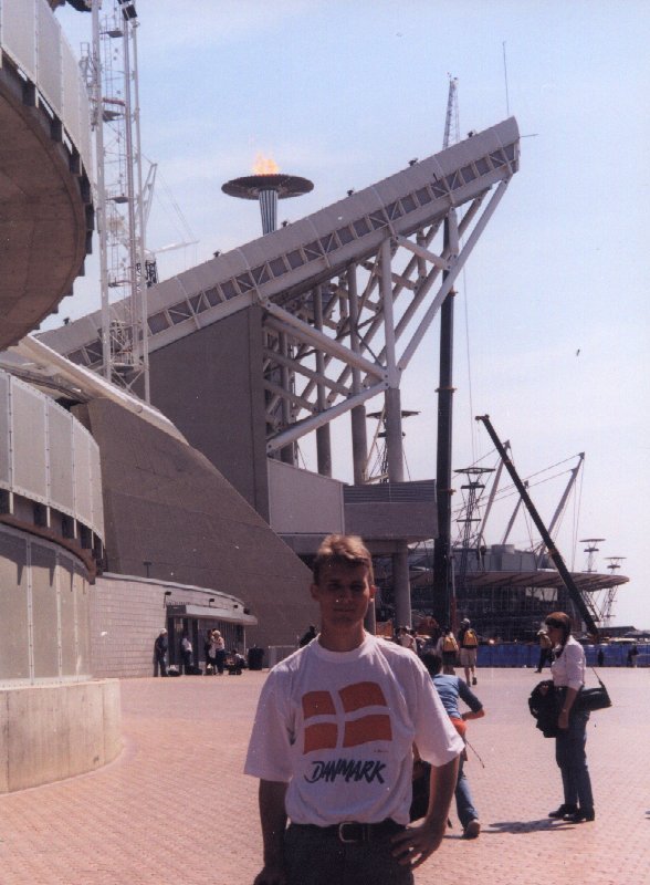
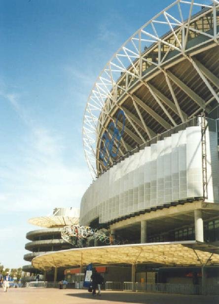
Here is Stadium Australia, where the Olympic torch is held. Most of the major track & field events, as well as athletics were held here. It is a pretty spectacular building - and HUGE. During the Olympics, you could not go into just any of the buildings at Olympic Park. You had to have a ticket for an event before you could enter the building.
As you can see me, I am wearing my T-shirt supporting Danmark! This is one of the few days that I can wear the T-shirt.
It was a very sunny and warm day and the place was full of people. During the Olympics, you could only get access to the whole of the Olympic Park if you had a ticket. They had quite tight security, and had to go through a detector on the perimeter of the grounds after you got off the train/bus.
The handball game started at about 2pm and we managed to wander round for quite a bit before going into the arena wear the handball was.
The food as amazingly expensive! Normally a fruit salad would only cost about AUD$3, cost up to AUD$8 that day!. Bottles of water was double the price. They really made it a money-making event for tourists! The funny thing too, we noticed that as you entered Olympic Park, all of the signs were in French and English, and all the announcements were given in French first, then English. It was most peculiar!
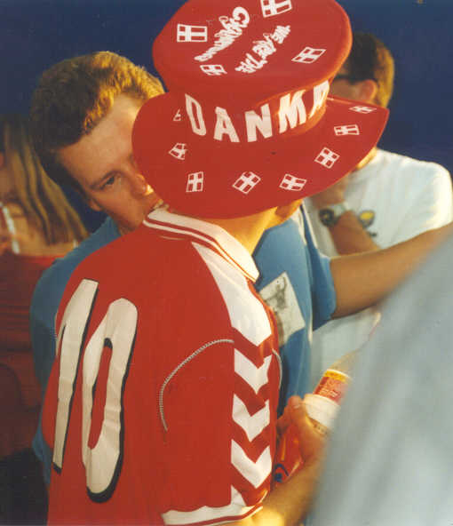
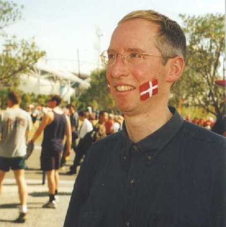
As we got closer to where the handball games were being held, we saw a lot of Danes and Norwegians dressed in country colours! Danes in red and white and Norwegians... well, there was a guy there who had lots of cow bells around his neck and attached to his clothes. He was wearing a traditional metal helmet and dressed in old-fashioned gear. It was amazing to feel all the atmosphere - just to be there.
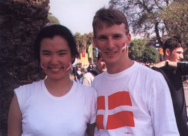
 We were all in the true Danish spirit! Even my girlfriend was dressed in a white T-shirt and red pants! We painted flags on our faces with some face paint. We were definitely there to support the Danish team!
Even Lance could not help get caught in the moment with us! *smile*
We were all in the true Danish spirit! Even my girlfriend was dressed in a white T-shirt and red pants! We painted flags on our faces with some face paint. We were definitely there to support the Danish team!
Even Lance could not help get caught in the moment with us! *smile*
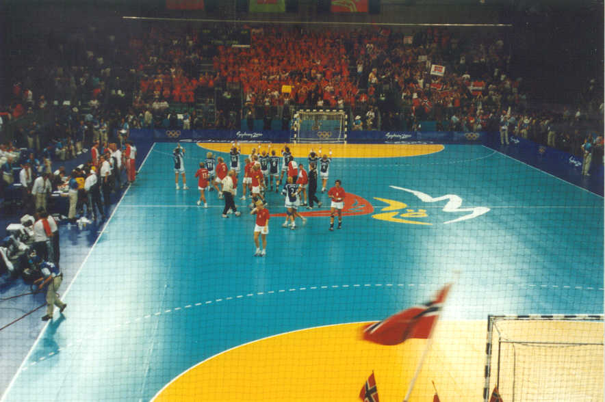 A break in the handball game - Danmark vs Norway!
Danmark in red & white, Norway in blue & white.
We had pretty good seats - it was a matter of whoever got there first, had the best seats, although we had to enter through certain doors.
All the journalists and officials sat on the left. We even heard that the crown prince of Danmark was there for the game, even though we could not spot him. There were flags everywhere, Danish and Norwegian waving about. Everytime Norway scored, you could hear countless numbers of cow-bells being rung! A few times, some of the people tried to start a Mexican wave, but that did not work out.
It was a very fast and furious game. It was the only handball game that the Danish lost in the whole Olympic Games, and they eventually came first in the finals!
A break in the handball game - Danmark vs Norway!
Danmark in red & white, Norway in blue & white.
We had pretty good seats - it was a matter of whoever got there first, had the best seats, although we had to enter through certain doors.
All the journalists and officials sat on the left. We even heard that the crown prince of Danmark was there for the game, even though we could not spot him. There were flags everywhere, Danish and Norwegian waving about. Everytime Norway scored, you could hear countless numbers of cow-bells being rung! A few times, some of the people tried to start a Mexican wave, but that did not work out.
It was a very fast and furious game. It was the only handball game that the Danish lost in the whole Olympic Games, and they eventually came first in the finals!
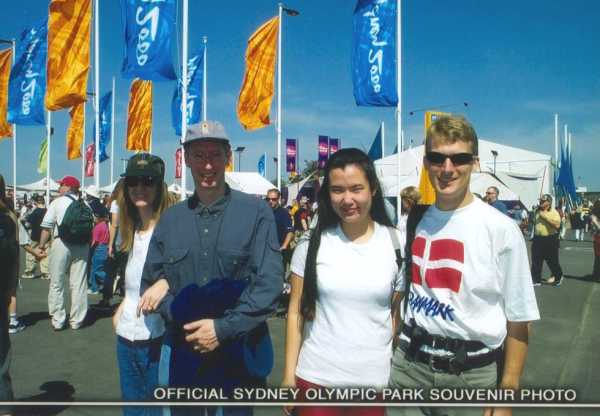
Just after entering Olympic Park, we managed to get a group photo!
As you can see the place is very crowded but very festive - you just had to be there!
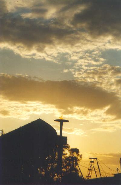
A most glorious sunset!
After the handball match, we wandered around for a bit longer. The day had been quite warm, so the night was a beautiful clear night.
After the Lenehans left, Arumi and I had a look at a small Aboriginal art exhibition located at the Park. We sat on one of the few grassy patches, to watch the flickering of the lights and just enjoy the day.
We eventually went home, but Olympic Park was still swarming with people, who were there to watch events that went on later into the night. Although we did not get the chance to see any other events during the Olympics, it was definitely worth the day we spent there. We would have loved to see the final game when Danmark won, but as usual, we were not very organised...
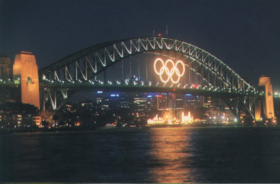
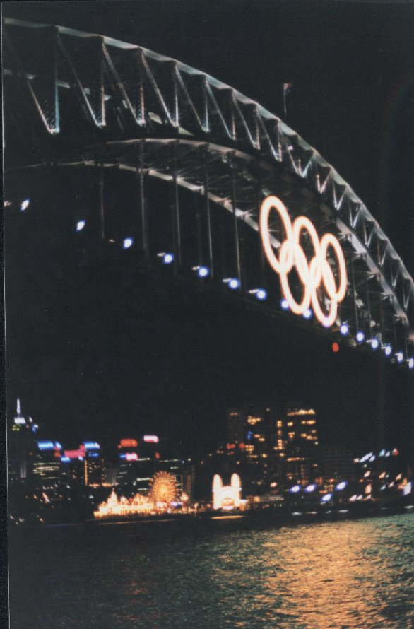
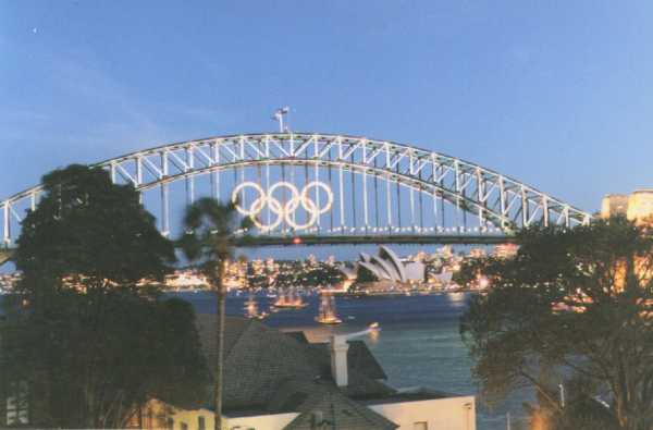
Below, I have included photos taken on the night of the Closing Ceremony.
These were taken from Graham's apartment on a hill at McMahons Point. We had a spectacular view of the fireworks that went off after the Closing Ceremony. It was really windy on the balcony, but I managed to get some photos of the Olympic rings that were placed on Sydney Harbour Bridge.
Beautiful, isn't it?
15. September 2000 11:05
by Rene Pallesen
0 Comments
In September 2000, just after I returned from my trip to Borneo, I had to buy this new car because my girlfriend had written off my car whilst I was away! *smile*
I did not look forward to hunting around for a new car, but I found a good buy locally. This car is a 1997 Ford Futura, with 4.0 litre, 6-cylinder, 220-horsepower, power-steering, central locking and electronic windows (I think I am starting to sound like a car advertisement...)
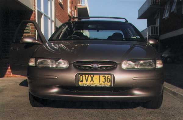

It is pretty much the same colour as my old car, and it feels so nice to drive!
As you can see, pretty similar, but I also really miss my old car! It had a lot of computerised features - from a digital odometer, to adjusting the internal temperature of the car. It was a pretty cool car and wished I could have kept it for another few more years.
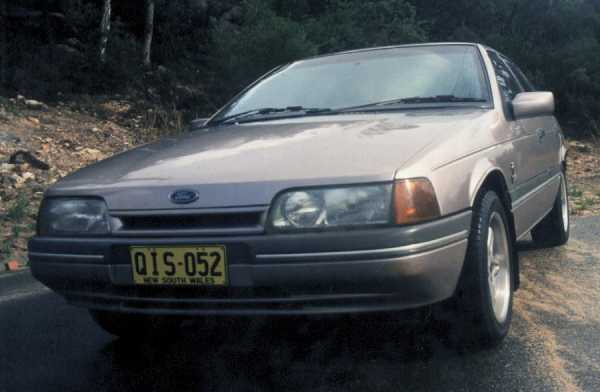

A huge contrast to my first car!
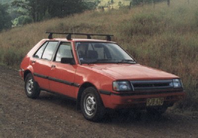
It is a red hatchback that I bought early 1998, a few months after I arrived in Australia. But someone wrote it off a few months after I bought it. It was a pretty bad accident, but luckily I was alright. I was only covered by Third Party insurance, and to go through a lot of paperwork just to get reimbursement for the car!
15. August 2000 10:43
by Rene Pallesen
0 Comments
Ecochallenge ( Sabah 2000 )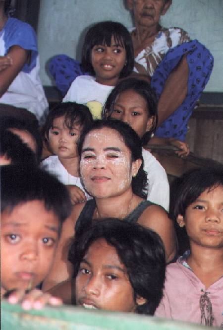 Away from Headquarters . . .I managed to explore the villages at Silam.
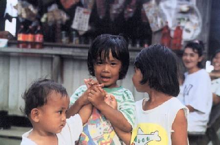
The people here wore this white stuff on their faces - I guess their form of sunscreen.
These people were refugees from the Philippines.
Away from Headquarters . . .I managed to explore the villages at Silam.
The people here wore this white stuff on their faces - I guess their form of sunscreen.
These people were refugees from the Philippines.
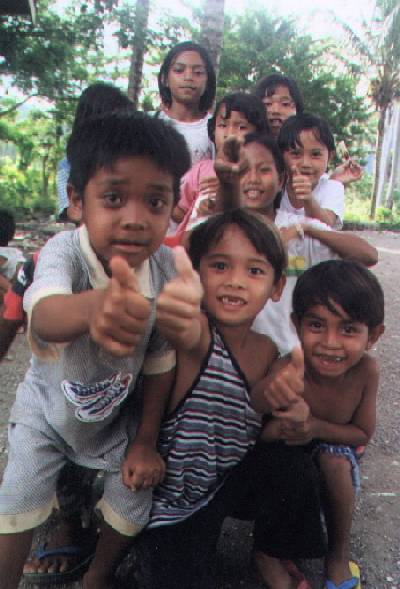
The kids were fighting to fit into the photo!
The kids here were really cute.
These kids here, had caught a monkey and was trying to sell it at the camp for 5 ringgit (AUD$2.50).
No-one wanted to buy it because they knew if they bought it, and set it loose, the kids would just catch it again, and try to sell it.
In general, there were lots of great photos at Silam village.
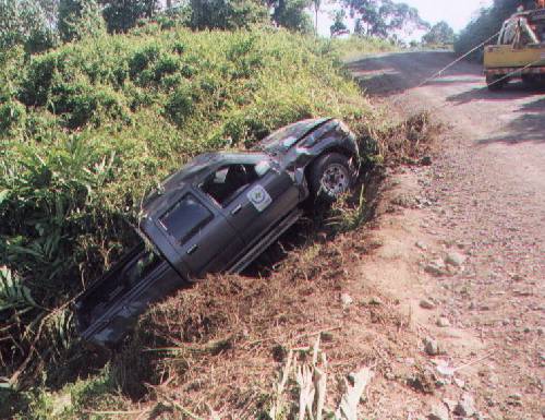
One of the helicopter pilots was driving through the jungle roads, took a corner too fast, and had a minor mishap.

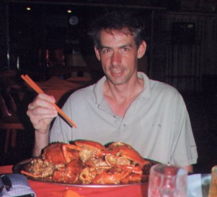 We headed into Lahad Datu to get some seafood!
An escape from camp food. Camp food was disgusting. There were live worms in the vegetables (yes, after cooked). Most of the food was not fresh, and was pretty boring. The seafood was fantastic here. Whenever we had the chance, we ate lots of seafood.
Yum... Paul did not get to eat all of the crabs - all of us had a portion of it.
We headed into Lahad Datu to get some seafood!
An escape from camp food. Camp food was disgusting. There were live worms in the vegetables (yes, after cooked). Most of the food was not fresh, and was pretty boring. The seafood was fantastic here. Whenever we had the chance, we ate lots of seafood.
Yum... Paul did not get to eat all of the crabs - all of us had a portion of it.
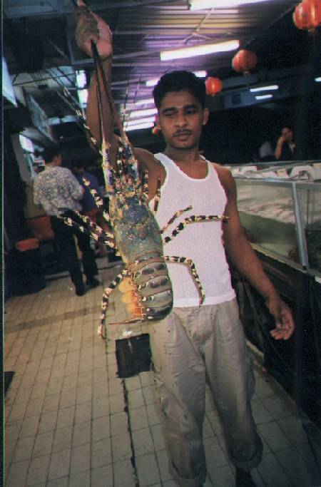
 Yummm... they were huge, but we did not eat them. They were too big for us to eat, pretty impressive though. They were the biggest lobsters I have seen in my life. We saw these at the same place we ate our seafood and frogs (below).

We had this frog for dinner about 2 min after I took the photo.
This was actually when I went out with Glen in Kota Kinabalu - he asked me to pick some food and to surprise him.
I did not tell him till a year later that he ate frog meat. He asked me what it was, because he reckoned it tasted funny, but I did not tell him at the time.
I think he will only eat it again. Only if he really had to.
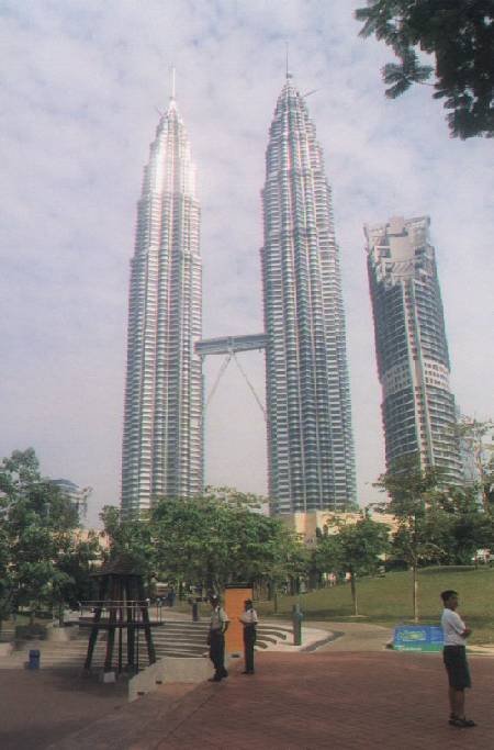
Petronis Towers - the tallest twin towers in the world.
Actually, they are the tallest buildings in the world, followed by the Sears Towers in Chicago.
The towers are joined by some sort pedestrian platform.
These towers are located in Kuala Lumpur.
I went to Kuala Lumpur to pick up my Permanent Residency for Australia.
Woohoo!!! After 2 years of lots of paperwork, and correspondence back and forth with Berlin, I finally managed to get it!
The inconvenience of it all, was that I actually had to leave Australia ie collect my PR before re-entering Australia.
Below, is the only photo I have of the Lateral Linking Team that I worked with during the race.
 Back to TopReturn to Borneo Homepage
Created: 7 Dec 2001
15. August 2000 10:42
by Rene Pallesen
0 Comments
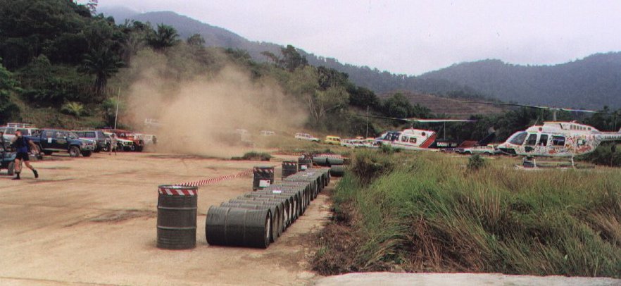
Ecochallenge ( Sabah 2000 )Helicopters . . .The radio communications team had to arrive a few days before that because we had to hand out over 2,000 pieces of radio equipment. We had problems getting the necessary approvals for helicopters so they were grounded! I ended having to hand out most of the equipment as Glen and Paul had to sort out our use of the helicopters.
We had to fly all the equipment to Silam before the start of the race, and our team managed to fly to Silam the day before the race started.
Do you believe that Paul managed to take a photo of me whilst I was flying the chopper? He was standing to the side of me, and took the photo at night time, with the door open ...
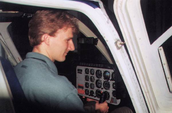
 Just kidding.
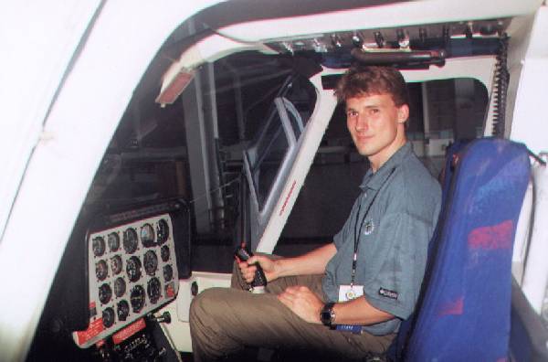
A couple of days before the race started, I was at the airport most of the day. We had some problems with the radios in the helicopters... I must have been in and out of those helicopters at least 200 times.
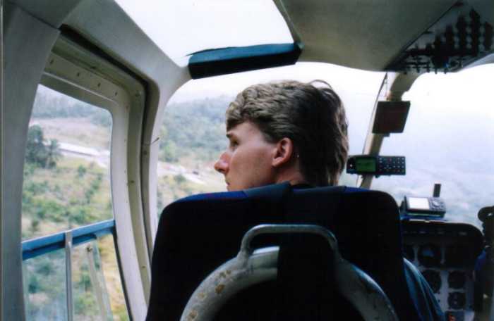
I did manage to get someone to take some photos of me in a helicopter, looking very much like the pilot!
I had hoped that I had the time to explore Kota Kinabalue, but we were so busy, it had to wait.
Just kidding.
A couple of days before the race started, I was at the airport most of the day. We had some problems with the radios in the helicopters... I must have been in and out of those helicopters at least 200 times.
I did manage to get someone to take some photos of me in a helicopter, looking very much like the pilot!
I had hoped that I had the time to explore Kota Kinabalue, but we were so busy, it had to wait.
 Here is the 212 or "Huey" - a twin-turbine Vietnam helicopter taking off. It is a hell a lot more powerful than some of the other helicopters we were using, which were 206s.
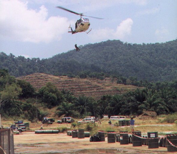 Here are the medical guys practising abseiling out of the helicopters (Aussie style)!
At the start of the race, I was sitting there listening to the first rescue on the radio.
3 hours after the start, four boats had capsized... helicopters and boats were very busy!
The competitors were due to arrive at Silam (another checkpoint) the next day (21st Aug).
For the first few days after the race started, I had to help organise to get the fuel to the top of the mountain.
After that the helicopter came in useful. It brought up 100 litres of fuel on the 4th day so I did not have to ferry fuel anymore!
Here are the medical guys practising abseiling out of the helicopters (Aussie style)!
At the start of the race, I was sitting there listening to the first rescue on the radio.
3 hours after the start, four boats had capsized... helicopters and boats were very busy!
The competitors were due to arrive at Silam (another checkpoint) the next day (21st Aug).
For the first few days after the race started, I had to help organise to get the fuel to the top of the mountain.
After that the helicopter came in useful. It brought up 100 litres of fuel on the 4th day so I did not have to ferry fuel anymore!
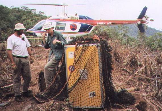
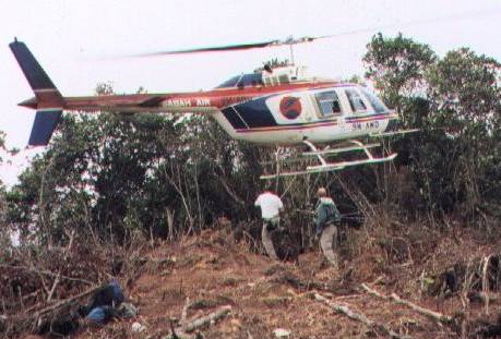 At the end of the race, we had to sling-load the repeaters, to get them off the mountain. That means we had to strap them onto the helicopters, and pull them off the mountains that way - quite effective really.
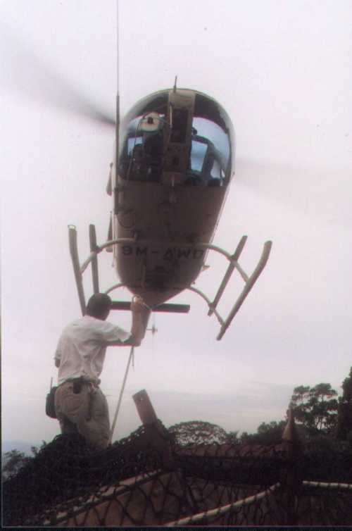
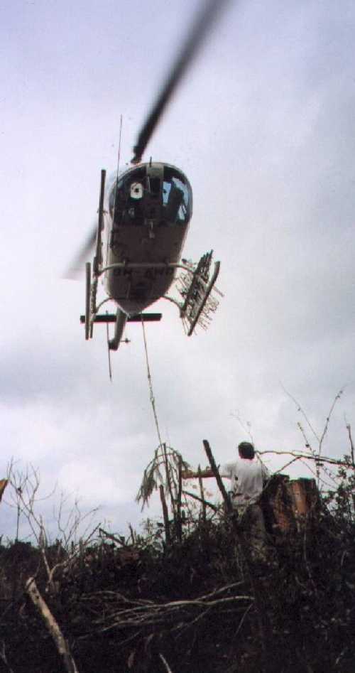
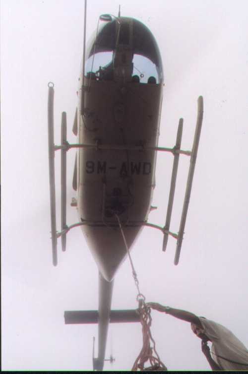
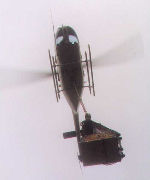
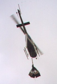
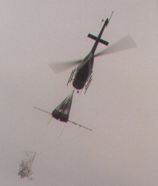
Repeater station finally airborne!
You can see a pole in the right photo.
My girlfriend asked me what it was for - it helps balance the load so that it does not keep swinging whilst airborne.
Below, you will see some pretty good photos from the chopper.
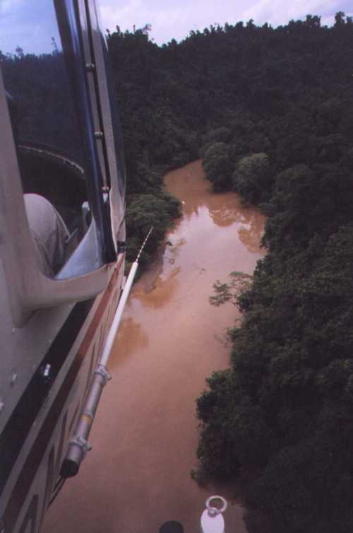
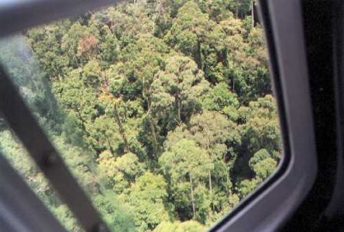
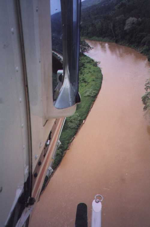 Towards the end of the race, we had to scan the rivers for the last competitors coming in - to make sure they had completed this section of the race course. It was low-altitude flying of the river-bed.
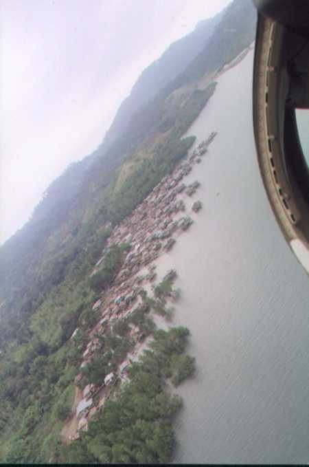
The photo on the left shows the chopper approaching Silam Village. This village was located just outside of Silam HQ.
Towards the end of the race, we had to scan the rivers for the last competitors coming in - to make sure they had completed this section of the race course. It was low-altitude flying of the river-bed.
The photo on the left shows the chopper approaching Silam Village. This village was located just outside of Silam HQ.
 Glen liked wanted to have a photo of the back of my head - and I ruined the photo by turning my head as he took it...
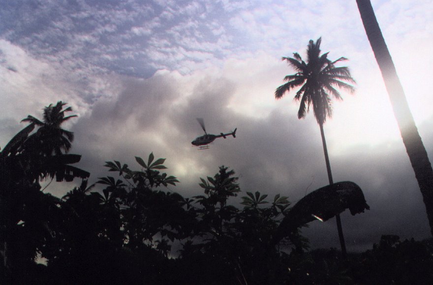
Here's a sunset shot of the helicopters flying around.
I had to put in this fantastic photo - the lighting gives a really nice feel to the photo.
Glen liked wanted to have a photo of the back of my head - and I ruined the photo by turning my head as he took it...
Here's a sunset shot of the helicopters flying around.
I had to put in this fantastic photo - the lighting gives a really nice feel to the photo.
 Back to TopReturn to Borneo Homepage
Created: 7 Dec 2001