28. July 2001 10:48
by Rene Pallesen
0 Comments
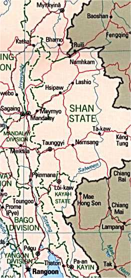 When I initially arrived in Yangon / Rangoon, I wanted to fly up Bhamo - one of the bigger towns north of Burma. I also considered exploring Myitkyinã - a town further north of Bhamo.
My Lonely Planet guide indicated that the only border crossing into China was to the east of Bhamo. My initial plans to Burma also included exploration of western China. However, I was disappointed by the military turning me back, despite the fact that my Lonely Planet guide said I could cross into China at Ruili.
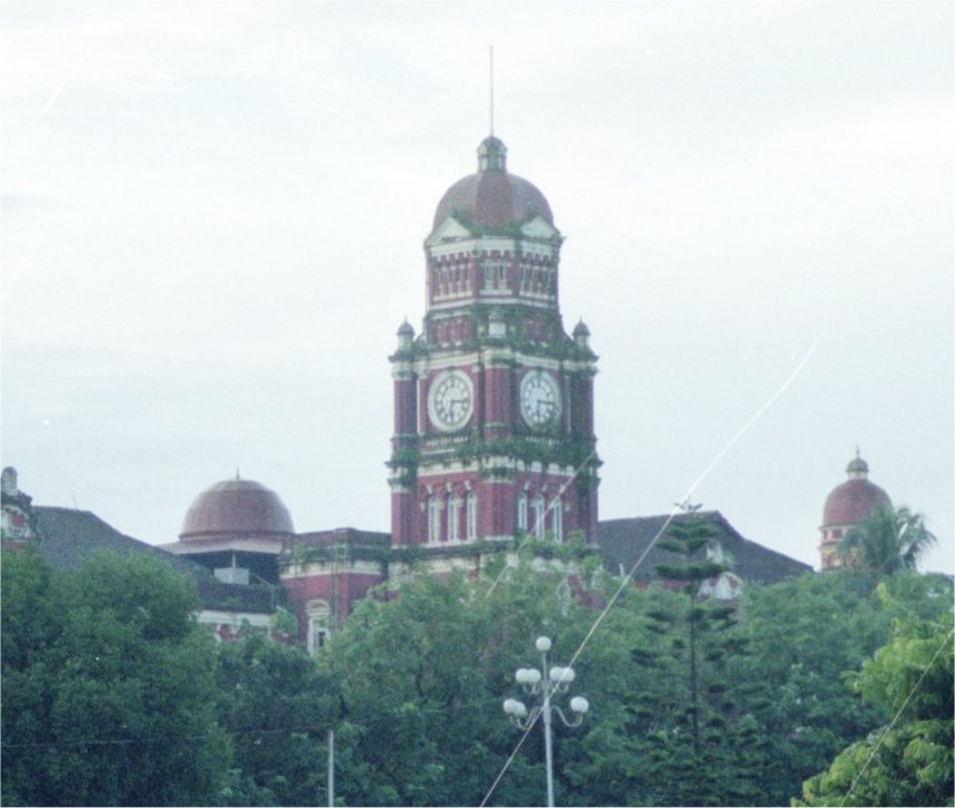
I decided instead to fly to Mandalay, not only because it was cheap to do so, but it saved me a 20-hour bus ride there from Yangon.
When I initially arrived in Yangon / Rangoon, I wanted to fly up Bhamo - one of the bigger towns north of Burma. I also considered exploring Myitkyinã - a town further north of Bhamo.
My Lonely Planet guide indicated that the only border crossing into China was to the east of Bhamo. My initial plans to Burma also included exploration of western China. However, I was disappointed by the military turning me back, despite the fact that my Lonely Planet guide said I could cross into China at Ruili.
I decided instead to fly to Mandalay, not only because it was cheap to do so, but it saved me a 20-hour bus ride there from Yangon.
 I heard about a song for sailors.
“To be a real sailor, the sailor would have to have been to Mandalay way upriver”
I quite liked Mandalay.
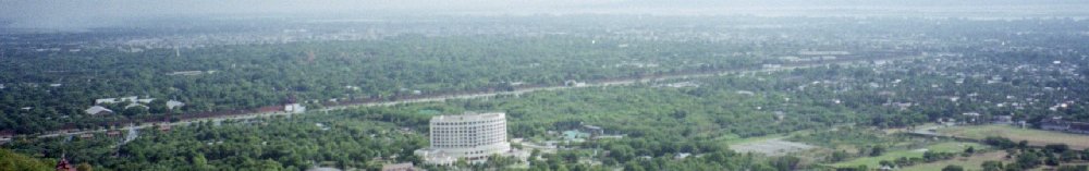
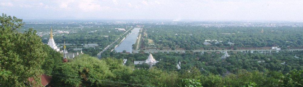
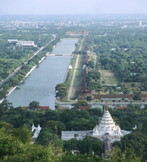
The photo below, is of Mandalay Hill.
During World War II (20 March 1945), the British and the Japanese fought one another to gain control of the position on this hill.
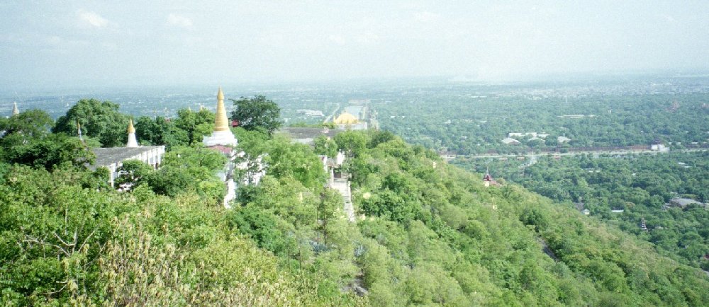
 The photo to the left is taken from the hill itself facing east - as you can see, it has an aerial view of the whole city, and puts any oncoming enemies at a disadvantage. Control of Mandalay was important during the war, as the soldiers were able to set up artillery and attack anyone approaching the fortress.
This hill was of big strategic importance.
The building you see near the shrine is a monument to the British regiment who managed to take control of this hill from the Japanese.
At the eastern part of the delta, a lot of logging takes place. There was a train line built that used to cart all the trees/wood for export to Thailand.
The photo to the left is taken from the hill itself facing east - as you can see, it has an aerial view of the whole city, and puts any oncoming enemies at a disadvantage. Control of Mandalay was important during the war, as the soldiers were able to set up artillery and attack anyone approaching the fortress.
This hill was of big strategic importance.
The building you see near the shrine is a monument to the British regiment who managed to take control of this hill from the Japanese.
At the eastern part of the delta, a lot of logging takes place. There was a train line built that used to cart all the trees/wood for export to Thailand.
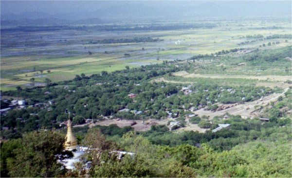
 The moat around the fortress is man-made.
Although man-made, comes from the local river.
The original fortress was burnt to the ground.
The whole fortress covered an area of 2.5 x 2.5 km
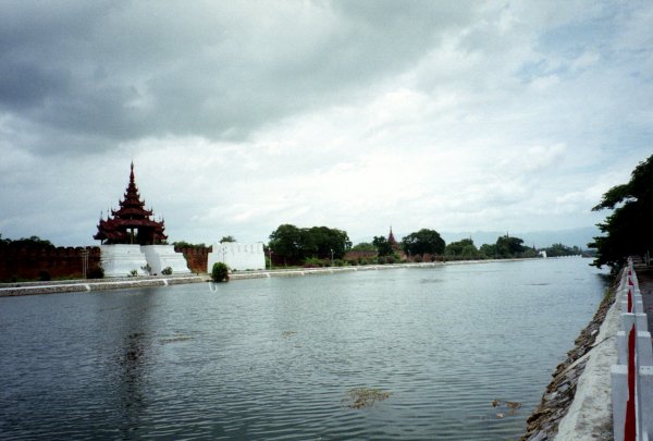
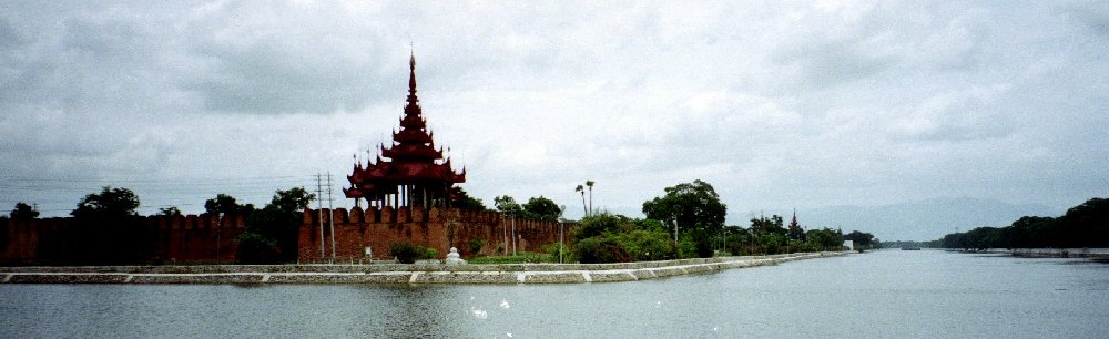
The design of Mandalay was quite colonial, and surprisingly, most of the streets were at 90º to one another.
Overall, I found Mandalay the most expensive city to travel to in Burma.
No matter what one does in Mandalay, be it explore Mandalay Hill or the city itself, the locals always had “special” foreigner prices. It really annoyed me.
I tried to use local currency as much as possible. However, FEC (Foreign Exchange Currency) was more valuable and worth more to the locals. FEC is also used in China, and one tries to use local currency as much as possible. Any item you buy has 2 prices - and obviously it is cheaper to use local currency than to use FEC.
I must admit, even Mandalay Hill was not that nice for the price I paid to explore it. It was also expensive just to go into the fortress.
Surprisingly, I could not find maps of the area that was not more that 40 years old.